Twin Tiers Land Surveying: Accurate Maps for NY-PA Projects
Property lines are not guesses. If you are a homeowner, builder, or buyer in the Twin Tiers, accurate measurements protect your budget, your plans, and your peace of mind. A few inches off can spark costly disputes, delays, or redesigns.
Twin Tiers Land Surveying is a trusted local expert based in Horseheads, NY, established in 1984. The team knows the hills, roads, and records across the New York and Pennsylvania Twin Tiers. That local knowledge helps turn complex sites into clear, buildable plans.
So what does land surveying cover? It maps boundaries, easements, and features on the ground, then documents them in clear reports and drawings. Think boundary surveys, site plans, and topographic maps that guide design, permits, and closings.
Working with Twin Tiers Land Surveying gives you clarity before you spend. You get accurate lines for fences and additions, solid data for builders, and fewer surprises at the closing table. Lenders and title companies like clean, well-documented surveys.
In this post, you will learn how Twin Tiers land surveying supports projects of every size. You will see when to order a survey, which type to pick, and how the process works. You will also get tips to speed up timelines and avoid common roadblocks.
Essential Services from Twin Tiers Land Surveying
The right survey saves time, money, and stress. Twin Tiers land surveying delivers clear maps and legally sound documents that keep projects in Horseheads and across NY-PA moving forward. Here is how the core services work for homes, farms, and commercial sites.
Boundary Surveys: Protecting Your Property Lines
A boundary survey confirms where your land begins and ends. Crews research deeds and records, locate or set monuments, then map the true edges with precise field measurements. The result is a clear line you can trust for fences, additions, and closings.
- Why it matters: Avoid neighbor disputes, stop encroachments, and support clean titles.
- Where it helps: From tight village lots in Horseheads to larger parcels on rural roads.
- How they measure: Modern GPS and total stations produce reliable positions within tight tolerances.
Example: Planning a privacy fence near your driveway in Elmira Heights? A boundary survey shows the fence location that keeps you on your side and out of trouble.
Site Plans: Planning Your Next Build with Confidence
Site plans lay out the proposed work on your lot. They show buildings, driveways, utilities, drainage, setbacks, and access in relation to property lines. Good plans match local codes so your submittal is review-ready.
- Benefits: Faster approvals, fewer revision cycles, and clearer bids for builders.
- Local fit: Designed to align with zoning in Chemung, Steuben, Tioga, and nearby counties.
- Cost control: Fewer surprises means fewer change orders and delays.
For a small shop in Horseheads or a new garage in Big Flats, a solid site plan smooths the permit path and keeps crews on schedule.
Topographic Surveys: Mapping the Terrain for Success
Topographic surveys map ground elevations and visible features, like slopes, trees, walls, culverts, and streams. In the hilly Twin Tiers, accurate contours guide design choices that work with the land, not against it.
- Design ready: Engineers and landscapers use topo data to set grades and drainage.
- Risk reduction: Spot low areas, steep cuts, and hidden drains before equipment rolls.
- Better outcomes: Smarter earthwork plans, safer access, and stronger stormwater control.
Thinking about a driveway on a hillside near Corning? A topo map shows the best route, the needed cut and fill, and the drainage details that protect your investment.
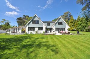
Why Twin Tiers Land Surveying Stands Out in Horseheads
 Photo by JACK REDGATE
Twin Tiers Land Surveying brings more than a map. With over 40 years in business, a small team of 5 to 9 specialists, and deep local roots in Horseheads, they deliver surveys that hold up in design meetings, permit reviews, and closings. Clients get clear answers, quick updates, and results that match the ground, not guesswork.
Local Expertise Tailored to Twin Tiers Challenges
Horseheads is their home base, and it shows in the work. Hills, clay soils, freeze-thaw cycles, and winding roads across Chemung, Steuben, Tioga, Schuyler, and Yates create unique survey hurdles. Add in NY-PA border quirks, deed history, and split jurisdiction rules, and experience becomes the edge.
Here is how that plays out in the field:
- Border-savvy: They read New York and Pennsylvania record styles, then tie them to what is actually on site.
- Terrain-ready: Crews plan for heavy canopy, creek crossings, and steep slopes so data stays tight.
- Permit-smart: Submittals align with county and town expectations, which keeps reviews moving.
A homeowner near the state line shared that the crew found a long-lost pin in brush, matched it to old records, and saved a fence plan from a costly shift. That is local knowledge at work.
Commitment to Precision and Customer Satisfaction
Accuracy sits at the core. The team uses modern GPS, total stations, and careful checks to deliver clean boundary lines, solid topo, and readable plats. Reports are detailed, labeled, and ready for engineers, title officers, and builders.
You also get responsive service:
- Quick turnaround during office hours, Monday to Friday, 8 AM to 4:30 PM.
- Personal contact with a surveyor who knows your site and goals.
- Revenue-backed reliability with $500K to $1M in annual work, which reflects steady demand and trust.
Call 607-739-9440 or email njr@twintierslandsurveying.com. If you want a neighborly team that delivers, Twin Tiers Land Surveying is a safe bet for NY-PA projects.
How the Twin Tiers Land Surveying Process Works Step by Step
Clear steps calm nerves. Here is how Twin Tiers Land Surveying moves your NY-PA project from first call to a map you can build on. You will see what you provide, when updates come, and how the team keeps things on schedule.
 Photo by Eyes2Soul
From Consultation to Final Map: What to Expect
You get a simple path with steady communication at each stage.
- Discovery and quote
- Share your address, deed, tax parcel ID, and project goals.
- Tip: Send any old surveys, plot plans, or title reports. They speed research.
- You receive a clear scope, a fee, and a target delivery window.
- Records research
- The office pulls deeds, plats, and county maps in NY or PA.
- If records conflict, they flag it early and explain options.
- You get a quick update when field work is scheduled.
- Field work and measurements
- Crews visit the site to locate corners, lines, and visible features using GPS and total stations.
- Tips for site day:
- Unlock gates and secure pets.
- Mark hazards like wells or wires.
- Clear light brush along lines if safe.
- Be available by phone in case a question comes up.
- You receive a same-day or next-day note that field work is complete.
- Analysis and drafting
- Surveyors compare field data with record evidence, then resolve any gaps.
- Drafters produce the boundary, topo, or site plan with labels and notes.
- Expect a heads-up if a record issue needs your decision before finalizing.
- Review and delivery
- You receive a draft PDF to confirm names, addresses, and any requested stakes or notes.
- After approval, you get the final stamped map and report in PDF. Printed copies are available on request.
- Tip: forward the final map to your builder, engineer, title company, or town clerk to keep permits and closing on track.
Timeline note: Twin Tiers gives a realistic date during the quote. Smaller lots finish faster. Wooded tracts, steep hills, and complex deeds can take longer. Communication stays steady from 8 AM to 4:30 PM, Monday to Friday, so you always know where things stand.
Conclusion
Clear maps, smart planning, and steady communication keep projects on track. With twin tiers land surveying, you get proven accuracy, strong records research, and results that match the ground. Local insight across the NY-PA line means cleaner deeds, smoother permits, and fewer surprises when dirt moves. Boundary lines are set with care, topo data fits the hills, and site plans read well for reviewers and builders. That is how you protect budgets, avoid disputes, and move from idea to build with confidence.
Ready to move forward? Reach out for a quote, share your goals, and get a survey that supports real decisions. Stop by 116 S Main St, Horseheads, NY, call 607-739-9440, or email njr@twintierslandsurveying.com. Homeowners, contractors, and buyers rely on this team for clear answers and reliable timelines. If your project touches a fence, an addition, a driveway, or a closing, start with a map you can trust.
Thanks for reading and for caring about doing it right. Your land deserves precise measurements and friendly service from people who know the area. Connect today, then build with clarity. Ask about timelines, site access tips, and deliverables to keep everyone aligned. The first step is a call or a quick email.


Post Comment